Iskaka
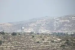
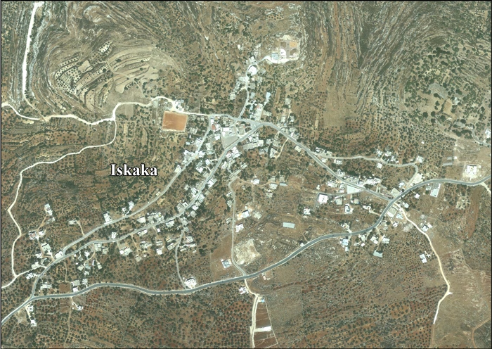
Iskaka (en árabe: إسكاكا) es una aldea ubicada en la gobernación de Salfit, en la Cisjordania ocupada (Palestina). Está situada 27 kilómetros al suroeste de Nablus. Según la Oficina Central de Estadísticas de Palestina, Iskaka tenía una población de 912 habitantes en 2007.[1]
| Iskaka | ||
|---|---|---|
| Entidad subnacional | ||
 | ||
| Coordenadas | 32°06′13″N 35°13′31″E | |
| Entidad | Pueblo | |
| • País |
| |
| Superficie | ||
| • Total | 5333 dunam (5,33 km²) | |
| Altitud | ||
| • Media | 522 m s. n. m. | |
| Población (2017) | ||
| • Total | 1198 hab. | |
| • Densidad | 0,22 hab./km² | |
| Huso horario | UTC+02:00 y UTC+03:00 | |
| Código postal | 392 | |
Bibliografía
- Barron, J.B., ed. (1923). Palestine: Report and General Abstracts of the Census of 1922. Government of Palestine.
- Conder, Claude Reignier (1882). The Survey of Western Palestine: Memoirs of the Topography, Orography, Hydrography, and Archaeology 2. Londres: Committee of the Palestine Exploration Fund. (p. 284)
- Dauphin, Claudine (1998). La Palestine byzantine, Peuplement et Populations. BAR International Series 726 (en francès). III : Catalogue. Oxford: Archeopress. ISBN 0-860549-05-4. (p. 811)
- Department of Statistics (1945). Village Statistics, April, 1945. Government of Palestine.
- Finkelstein, I. (1997). Highlands of many cultures. Tel Aviv: Institute of Archaeology of Tel Aviv University Publications Section. ISBN 965-440-007-3.(p. 611)
- Guérin, V. (1875). Description Géographique Historique et Archéologique de la Palestine (en francès). 2: Samarie, pt. 2. París: L'Imprimerie Nationale. (p. 163)
- Hadawi, S. (1970). Village Statistics of 1945: A Classification of Land and Area ownership in Palestine. Palestine Liberation Organization Research Center.
- Hütteroth, Wolf-Dieter (1977). Historical Geography of Palestine, Transjordan and Southern Syria in the Late 16th Century. Erlanger Geographische Arbeiten, Sonderband 5. Erlangen, Germany: Vorstand der Fränkischen Geographischen Gesellschaft. ISBN 3-920405-41-2. (p. 131)
- Mills, E., ed. (1932). Census of Palestine 1931. Population of Villages, Towns and Administrative Areas. Jerusalem: Government of Palestine.
- Palmer, E.H. (1881). The Survey of Western Palestine: Arabic and English Name Lists Collected During the Survey by Lieutenants Conder and Kitchener, R. E. Transliterated and Explained by E.H. Palmer. Committee of the Palestine Exploration Fund. (p. 229)
Referencias
- 2007 PCBS Census (enlace roto disponible en este archivo). Oficina Central de Estadísticas de Palestina. p. 112.
Enlaces externos
- Palestine Remembered: Welcome To Iskaka (en inglés)
- Iskaka Village (Fact Sheet) ARIJ (PDF) (en inglés)
- Iskaka aerial photo, ARIJ (en inglés)
| Control de autoridades |
|
|---|
Este artículo ha sido escrito por Wikipedia. El texto está disponible bajo la licencia Creative Commons - Atribución - CompartirIgual. Pueden aplicarse cláusulas adicionales a los archivos multimedia.